Below is a list of National Parks, Monuments, and Landmarks I have been to. This list was compiled with the help of Wikipedia
Use the National Parks menu above to view the galleries of some of the NP I have been to. ..
Navigation by WebRing.
National Parks
| Acadia |  |
Maine |
01919-02-26February 26, 1919 | 700447389670000000047,389.67 acres (191.8 km2) | Covering most of Mount Desert Island and other coastal islands, Acadia preserves the tallest mountain on the Atlantic coast, granite peaks, ocean shoreline, woodlands, and lakes. There are freshwater, estuary, forest, and intertidal habitats.[6] |
|---|
| Arches | 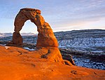 |
Utah |
01971-11-12November 12, 1971 | 700476518980000000076,518.98 acres (309.7 km2) | This site features more than 2,000 natural sandstone arches, including the Delicate Arch. In a desert climate millions of years of erosion have led to these structures, and the arid ground has life-sustaining soil crust and potholes, natural water-collecting basins. Other geologic formations are stone columns, spires, fins, and towers.[8] |
|---|
| Badlands |  |
South Dakota |
01978-11-10November 10, 1978 | 7005242755940000000242,755.94 acres (982.4 km2) | The Badlands are a collection of buttes, pinnacles, spires, and grass prairies. It has the world’s richest fossil beds from the Oligocene epoch, and there is wildlife including bison, bighorn sheep, black-footed ferrets, and swift foxes.[9] |
|---|
| Black Canyon of the Gunnison |  |
Colorado |
01999-10-21October 21, 1999 | 700432950030000000032,950.03 acres (133.3 km2) | The park protects a quarter of the Gunnison River, which has dark canyon walls from the Precambrian era. The canyon has very steep descents, and it is a site for river rafting and rock climbing. The narrow, steep canyon, made of gneiss and schist, is often in shadow, appearing black.[ |
|---|
List of U.S. National Historic Landmarks by state ArizonaCaliforniaColoradoHawaiiNew YorkSouth CarolinaSequoia California
![]() 36°26′N 118°41′W / 36.43°N 118.68°W / 36.43; -118.68 (Sequoia)01890-09-25September 25, 18907005404051170000000404,051.17 acres (1,635.1 km2)This park protects the Giant Forest, which has the world’s largest tree, General Sherman, as well as four of the next nine. It also has over 240 caves, the tallest mountain in the lower 48 states, Mount Whitney, and the granite dome Moro RockLake Mead National Recreation Area
36°26′N 118°41′W / 36.43°N 118.68°W / 36.43; -118.68 (Sequoia)01890-09-25September 25, 18907005404051170000000404,051.17 acres (1,635.1 km2)This park protects the Giant Forest, which has the world’s largest tree, General Sherman, as well as four of the next nine. It also has over 240 caves, the tallest mountain in the lower 48 states, Mount Whitney, and the granite dome Moro RockLake Mead National Recreation Area
![]() 36°00′56″N 114°44′16″W / 36.015556°N 114.737778°W / 36.015556; -114.737778 (Hoover Dam)Mohave, AZ and Clark, NVHistoric dam, power plant and water-storage facility67New York Stock Exchange
36°00′56″N 114°44′16″W / 36.015556°N 114.737778°W / 36.015556; -114.737778 (Hoover Dam)Mohave, AZ and Clark, NVHistoric dam, power plant and water-storage facility67New York Stock Exchange 2 June 1978ManhattanNew YorkOne of the first securities markets in the U.S.; still the world’s largest
| Bryce Canyon | 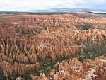 |
Utah |
01928-02-25February 25, 1928 | 700435835080000000035,835.08 acres (145.0 km2) | Bryce Canyon is a giant natural amphitheatre along the Paunsaugunt Plateau. The unique area has hundreds of tall hoodoos formed by erosion. The region was originally settled by Native Americans and later by Mormon pioneers.[13] | |
|---|---|---|---|---|---|---|
| Canyonlands |  |
Utah |
01964-09-12September 12, 1964 | 7005337597830000000337,597.83 acres (1,366.2 km2) | This landscape was eroded into canyons, buttes, and mesas by the Colorado River, Green River, and their tributaries, which divide the park into four districts. There are rock pinnacles and other naturally sculpted rock, as well as artifacts from Ancient Pueblo Peoples.[14] | |
| Capitol Reef |  |
Utah |
01971-12-18December 18, 1971 | 7005241904260000000241,904.26 acres (979.0 km2) | The park’s Waterpocket Fold is a 100-mile (160 km) monocline that shows the Earth’s geologic layers. Other natural features are monoliths and sandstone domes and cliffs shaped like the United States Capitol.[15] | |
| Carlsbad Caverns | 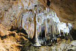 |
New Mexico |
01930-05-14May 14, 1930 | 700446766450000000046,766.45 acres (189.3 km2) | Carlsbad Caverns has 117 caves, the longest of which is over 120 miles (190 km) long. The Big Room is almost 4,000 feet (1,200 m) long, and the caves are home to over 400,000 Mexican Free-tailed Bats and sixteen other species. Above ground are the Chihuahuan Desert and Rattlesnake Springs.[16] | |
| Grand Canyon |  |
Arizona |
01919-02-26February 26, 1919 | 70061217403320000001,217,403.32 acres (4,926.7 km2) | The Grand Canyon, carved out by the Colorado River, is 277 miles (446 km) long, up to 1 mile (1.6 km) deep, and up to 15 miles (24 km) wide. Millions of years of exposure has formed colorful layers of the Colorado Plateau in mesas and canyon walls.[29] | |
| Grand Teton |  |
Wyoming |
01929-02-26February 26, 1929 | 7005309994659900000309,994.66 acres (1,254.5 km2) | Grand Teton is the tallest mountain in the Teton Range. The park’s Jackson Hole valley and reflective piedmont lakes contrast with the tall mountains, which abruptly rise from the glacial sage-covered valley.[ | |
| Great Sand Dunes |  |
Colorado |
02004-09-13September 13, 2004 | 700442983740000000042,983.74 acres (173.9 km2) | The tallest dunes in North America are up to 750 feet (230 m) tall and neighbor grasslands, shrublands and wetlands. They were formed by sand deposits of the Rio Grande on the San Luis Valley. The park also has alpine lakes, six 13,000-foot mountains, and ancient forests.[32] | |
| Great Smoky Mountains |  |
North Carolina, Tennessee |
01934-06-15June 15, 1934 | 7005521490130000000521,490.13 acres (2,110.4 km2) | The Great Smoky Mountains, part of the Appalachian Mountains, have a wide range of elevations, making them home to over 400 vertebrate species, 100 tree species, and 5000 plant species. Hiking is the park’s main attraction, with over 800 miles (1,300 km) of trails, including 70 miles (110 km) of the Appalachian Trail. Other activities are fishing, horseback riding, and visiting some of nearly 80 historic structures | |
| Mammoth Cave | 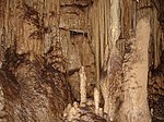 |
Kentucky |
01941-07-01July 1, 1941 | 700452830190000000052,830.19 acres (213.8 km2) | With 392 miles (631 km) of passageways mapped, Mammoth Cave is by far the world’s longest cave system. Cave animals include eight bat species, Kentucky cave shrimp, Northern cavefish, and cave salamanders. Above ground, the park contains Green River (Kentucky), 70 miles of hiking trails, sinkholes, and springs.[46] | |
| Mesa Verde | 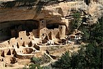 |
Colorado |
01906-06-29June 29, 1906 | 700452121930000000052,121.93 acres (210.9 km2) | This area has over 4,000 archaeological sites of the Ancestral Pueblo, who lived here for 700 years. Cliff dwellings built in the 12th and 13th centuries include Cliff Palace, which has 150 rooms and 23 kivas, and the Balcony House, with passages and tunnels | |
| Petrified Forest |  |
Arizona |
01962-12-09December 9, 1962 | 700493532570000000093,532.57 acres (378.5 km2) | This portion of the Chinle Formation has a great concentration of 225-million-year-old petrified wood. The surrounding region, the Painted Desert, has eroded red-hued volcanic rock called bentonite. There are also dinosaur fossils and over 350 Native American sites.[51] | |
| Pinnacles |  |
California |
02013-01-10January 10, 2013 | 700426605730000000026,605.73 acres (107.7 km2) | Known for the namesake eroded leftovers of half of an extinct volcano, it is popular for its rock climbing.[52] | |
| Redwood |  |
California |
01968-10-02October 2, 1968 | 7005112512050000000112,512.05 acres (455.3 km2) | This park and the co-managed state parks protect almost half of all remaining Coastal Redwoods, the tallest trees on Earth. There are three large river systems in this very seismically active area, and the 37 miles (60 km) of protected coastline have tide pools and seastacks. The prairie, estuary, coast, river, and forest ecosystems have varied animal and plant species.[53] | |
| Rocky Mountain | 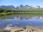 |
Colorado |
01915-01-26January 26, 1915 | 7005265828409999999265,828.41 acres (1,075.8 km2) | This section of the Rocky Mountains has ecosystems varying in elevation from the over 150 riparian lakes to Montane and subalpine forests to the alpine tundra. Large wildlife including mule deer, bighorn sheep, black bears, and cougars inhabit these igneous mountains and glacier valleys. The fourteener Longs Peak and Bear Lake are popular destinations.[54] | |
| Yellowstone |  |
Wyoming, Montana, Idaho |
01872-03-01March 1, 1872 | 70062219790710000002,219,790.71 acres (8,983.2 km2) | Situated on the Yellowstone Caldera, the first national park in the world has vast geothermal areas such as hot springs and geysers, the best-known being Old Faithful and Grand Prismatic Spring. The yellow-hued Grand Canyon of the Yellowstone River has numerous waterfalls, and four mountain ranges run through the park. There are almost 60 mammal species, including the gray wolf, grizzly bear, lynx, bison, and elk.[63] | |
| Yosemite |  |
California |
01890-10-01October 1, 1890 | 7005761266189900000761,266.19 acres (3,080.7 km2) | Yosemite has towering cliffs, waterfalls, and sequoias in a diverse area of geology and hydrology. Half Dome and El Capitan rise from the central glacier-formed Yosemite Valley, as does Yosemite Falls, North America’s tallest waterfall. Three Giant Sequoia groves and vast wilderness are home to diverse wildlife.[64] | |
| Zion | 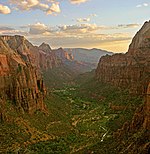 |
Utah |
01919-11-19November 19, 1919 | 7005146597600000000146,597.60 acres (593.3 km2) | This geologically unique area has colorful sandstone canyons, high plateaus, and rock towers. Natural arches and exposed formations of the Colorado Plateau make up a large wilderness of four ecosystems | |
| Devils Tower |  |
NPS | Wyoming |
01906-09-24September 24, 1906 | The tower is a monolithic igneous intrusion of volcanic neck rising dramatically 1,267 feet (386 m) above the surrounding terrain. Proclaimed by Theodore Roosevelt, this was the first national monument.[ | |
| Florissant Fossil Beds |  |
NPS | Colorado |
01969-08-20August 20, 1969 | Huge petrified redwoods and incredibly detailed fossils of ancient insects and plants reveal a very different landscape in Colorado of almost 35 million years ago in the Eocene age.[ | |
| Fort Sumter |  |
NPS | South Carolina |
01948-04-28April 28, 1948 | Fort Sumter is a Third System masonry coastal fortification located in Charleston harbor, South Carolina. It is best known as the site where the shots initiating the American Civil War were fired, at the Battle of Fort Sumter. Nearby Fort Moultrie is a unit of this monument; it was made of palmetto logs and inspired the flag and nickname (Palmetto State) of South Carolina | |
| Giant Sequoia |  |
USFS | California |
02000-04-15April 15, 2000 | The monument includes 38 of the 39 Giant Sequoia groves in the Sequoia National Forest, amounting to about half of the sequoia groves currently in existence. This includes one of the ten largest Giant Sequoias, the Boole Tree. Its two parts are around Kings Canyon and Sequoia National Parks | |
| Jewel Cave |  |
NPS | South Dakota |
01908-02-07February 7, 1908 | Jewel Cave is the second longest cave in the world, with about 141 miles (227 km) of mapped passageways. In the Black Hills, it was discovered in 1900 and is so named because of its calcite crystals | |
| White Sands | 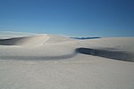 |
NPS | New Mexico 32°47′N 106°10′W / 32.78°N 106.17°W / 32.78; -106.17 (White Sands) |
01933-07-25July 25, 1933 | Located in the mountain-ringed Tularosa Basin valley area, White Sands consists of the southern part of a 275 square miles (710 km2) field of white sand dunes composed of gypsum crystals. It is completely within the White Sands Missile Range and is subject to closure when tests are conducted | |
| Grand Canyon Lodge | 01987-05-28May 28, 1987 | North Rim, Grand Canyon National Park | Coconino | Lodge at Bright Angel Point, on North Rim of Grand Canyon | ||
| 14 | Grand Canyon Park Operations Building |  |
01987-05-28May 28, 1987 | Grand Canyon Village |
Coconino | National Park Service building; built in 1929; designed to blend with the natural surroundings |
| Grand Canyon Village |  |
01987-02-18February 18, 1987 | Grand Canyon Village | Coconino | Planned town significant for its urban planning and ecological sensitivity | |
| 17 | Hoover Dam |  |
01985-08-20August 20, 1985 | |||
| Alcatraz Island |  |
01986-01-17January 17, 1986 | San Francisco |
San Francisco | Former maximum security Federal prison; Frank Morris escaped, but few others did; part of Golden Gate National Recreation Area; visited by tourist ferries. | |
| Cripple Creek Historic District |  |
01961-07-04July 4, 1961 | Cripple Creek |
Teller | The gold mining town of Cripple Creek and the surrounding hills | |
| 5 | Durango-Silverton Narrow-Gauge Railroad |  |
01961-07-04July 4, 1961 | Durango to Silverton |
San Juan and La Plata | Narrow gauge mining railroad which has continued to serve as a tourist line between Durango and Silverton |
| Pikes Peak |  |
01961-07-04July 4, 1961 | Colorado Springs |
El Paso | Pike’s Peak (everything above 14,000 feet (4,300 m) elevation). This mountain was inspiration for “America the Beautiful” as well as the motto “Pike’s Peak or Bust“ | |
| Raton Pass |  |
01960-12-19December 19, 1960 | Trinidad, CO and Raton, NM |
Las Animas, CO and Colfax, NM | Mountain pass between New Mexico and Colorado | |
| 17 | Rocky Mountain National Park Administration Building |  |
02001-01-03January 3, 2001 | Estes Park |
Larimer | Also known as the Beaver Meadows Visitor Center, it was designed by Taliesin Associated Architects, their first major work after Frank Lloyd Wright had died. It demonstrated modern architecture could be successful inside the National Parks and was the last significant project in Mission 66 |
| Silverton Historic District |  |
01961-07-04July 4, 1961 | Silverton |
San Juan | Former silver mining town, home of the Shenandoah-Dives (Mayflower) Mill and one end of the Durango-Silverton Narrow-Gauge Railroad | |
| United States Air Force Academy, Cadet Area |  |
02004-04-01April 1, 2004 | Colorado Springs |
El Paso | Bold use of Modern architecture at the United States Air Force Academy, especially with the Cadet Chapel | |
| USS Arizona (shipwreck) |  |
01989-05-05May 5, 1989 | Pearl Harbor |
Oʻahu | Sunken remains of the USS Arizona; destroyed in battle during the Japanese attack on Pearl Harbor. Now the centerpiece of the NRHP USS Arizona Memorial | |
| Brooklyn Bridge |  |
29 January 1964 | Brooklyn and Manhattan |
Kings and New York | The first steel wire suspension bridge; at one point the largest in the world; inspiration for Hart Crane‘s poem, “The Bridge“ | |
| Central Park |  |
23 May 1963 | Manhattan |
New York | The Green Lung of the city; one of the most visited city parks in the world; designed by Frederick Law Olmsted and Calvert Vaux | |
| City Hall |  |
19 December 1960 | Manhattan |
New York | Oldest city hall in U.S. still in use as main municipal government building | |
| Empire State Building |  |
24 June 1986 | Manhattan |
New York | Current tallest building in New York and internationally-recognized symbol of the city | |
| Holland Tunnel |  |
4 November 1993 | Manhattan | New York | Tunnel underneath the Hudson River, connecting Manhattan and New Jersey; civil engineering landmark; one of the earliest ventilated tunnels | |
| 48 | USS Intrepid |  |
14 January 1986 | Manhattan | New York | One of the most active U.S. ships during World War II; today a museum moored along the West Side |
| R. H. Macy and Company Store (Macy’s) |  |
2 June 1978 | Manhattan | New York | Largest department store in world for many years | |
| New York Public Library |  |
21 December 1965 | Manhattan | New York | One of the largest and most important libraries in the U.S. | |
| Rockefeller Center |  |
23 December 1987 | Manhattan | New York | Successful urban planning projects of 20th-century America; changed Midtown Manhattan; originating site of popular NBC television programs Today and Saturday Night Live | |
| Trinity Church | 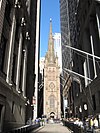 |
8 December 1976 | Manhattan | New York | Historic church which looks down Wall Street | |
| Charleston Historic District |  |
01960-10-09October 9, 1960 | Charleston | Charleston | Historic district including 81 contributing properties and 700 others | |
| USS YORKTOWN (Aircraft Carrier) |  |
01986-01-14January 14, 1986 | Mount Pleasant |
Charleston | Famous World War II aircraft carrier |
